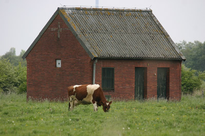
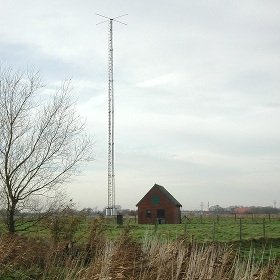
A disappointment when we arrived at the surroundings of this beacon, no beacon to see! We had used the route below, made with Google Earth. Luckily I had put my Laptop computer with my luggage and I had saved a GE photo from this place on it. After viewing this photo we came to the conclusion that we where at the right spot and that the building in the field once had belonged to the beacon.
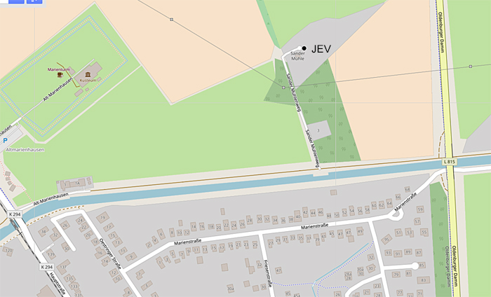
This beacon was located just north of the village of Sande.
At the A29 direction Wilhelmshaven we took exit 5 (Wilhelmshaven west) onto road 210.
Take first road to the right direction Sande, Oldenburgerdamm (L815.)
The beacon was possible visible at the RHS when driving on this road.
At the point with an industrial zone left, turn right into Sande, Hauptstrasse.
Follow this road until you are crossing the Canal.
Direct after the bridge turn right onto the road along the canal Alt Marienhausen.
Take the second road to the left – Sander Mühlenweg.
After two (farm) houses at your right there was after ca 100 metres a path to the location of the beacon.
July 2011. I got a photo from Michael Oexner with the JEV beacon.